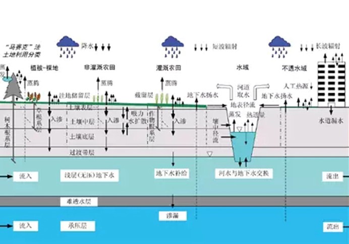
水文模型
来源:科学网博客 作者:陈昌春
水文模型在气候变化与水资源问题日益引起关注的当代具有丰富的应用前景。现对水文模型作一些介绍。
目前堪称水文模型龙头老大的开放兼开源软件是SWAT(行业老大的SHE水文模型集群是商业软件,与ARCGIS在地理信息领域的地位相似),它在水文模拟、环境模拟、气候模拟领域已经大显身手,国内最近出版了SWAT模型从使用方法到理论文件的译作三大册。《中国气象报》甚至用《SWAT模型:让水资源评估"技高一筹"》进行了专题报道。
现提供一位国内网友http://swatmodel.blog.sohu.com/关于SWAT从安装到使用的服务一条龙的综合页面。
在当今的水文模型搜索与介绍网站中,堪称水文模型、地表模型(地貌过程等)、海岸模型等地学模型世界第一门户的http://csdms.colorado.edu/wiki/Model_download_portal网站中的模型总数已达166个,提供源程序下载链接或者内容介绍,堪称地学模型超级仓库。
就国内而言,尽管研发的水文模型数量已不在少数,但多羞羞答答、不愿公开程序,总体而言未成气候。寒旱所建设的冰雪冻土环境本底与可持续发展专题数据库提供了部分国外水文模型的下载,可称水文模型小型展览馆http://www.cryosphere.csdb.cn/html/modelList.jsp
下面介绍一些常见的水文模型:
BASINS流域模型系统——水文模型大套餐
官方下载网址http://water.epa.gov/scitech/datait/models/basins/index.cfm
美国环保署的BASINS流域模型整合了HSPF、SWAT、PLOAD、AGWA等水文模型,在非点源污染等领域有广泛的应用。国内已出版《流域水文水质模拟软件HSPF应用指南》。
SWIM水文模型(德国)
官方下载网址:http://www.pik-potsdam.de/research/climate-impacts-and-vulnerabilities/models/swim/swim-description此模型国内已有一本应用类书籍出版。
颇具特色然而难度系数较高的大尺度VIC水文模型
VIC水陆两用模型由华人梁旭女士读博期间牵头开发,其内核与原理与河海大学早年出生的国际名模—新安江模型据称有密切的关联,可惜新安江未能以电子化产品占领国际市场,遂至美人迟暮,近年主要现身于国内水科学研究舞台。VIC模型的版权属于美国华盛顿大学等。
VIC在国内运用的典范之作可能当属河海大学吴志勇博士的全国百篇优秀博士论文《定量降雨与实时洪水预报研究》,在吴志勇博士论文的基础上,他与其导师合作撰著的《水文循环过程及定量预报》已经由科学出版社2010年出版。据该书提要称:本书详细介绍了流域水文循环关键要素大气水、降水、蒸发的计算、预报、估算的技术与方法,并分别给出了大气水分析计算实例、定量降水估算、预报技术与方法的应用实例、蒸发估算方法及其在干旱监测预测中的应用实例等;探讨了陆面过程模型和大尺度水文模型应用中的技术问题。
VIC水文模型由C语言编写,linux系统运行(可用CYGWIN等进行仿真),命令行操作,不太方便。
VIC模型官网下载网页:http://www.hydro.washington.edu/Lettenmaier/Models/VIC/
与VIC同出一门的区域尺度水文模型—DHSVM
DHSVM模型官网下载网页http://www.hydro.washington.edu/Lettenmaier/Models/DHSVM/index.shtml
小巧玲珑的TOPMEDEL水文模型
TOPMEDEL水文模型属于比较概化的水文模型,常被称作半分布式水文模型。
常用于计算不透水面水文影响的LTHIA水文模型
LTHIA目前作为ARCVIEW GIS的一个模块进行运行。
暴雨水文模型SWMM
官网下载网址:http://www.epa.gov/nrmrl/wswrd/wq/models/swmm/
在城市内涝日益引起注意的今天,SWMM将得到广泛的重视。
HBV水文模型
下载网址:http://people.su.se/~jseib/HBV/HBV_light.html
美国ucdavis(加州理工学院davis分校)提供的流域模型列表
http://cwam.ucdavis.edu/models.htm
Watershed Modeling
This page connects you to descriptions of computer models designed to address particular watershed functions or processes. It includes models for hydrology, ecology, water quality, overall watershed condition, and other topic areas. You can scroll down through the list, or "Quick Link" to a category of models in the pull-down list below. The model title is highlighted in the left-hand column, and its corresponding short description is to the right. Just click on th model title to go to the description, which is a "pdf" file.
得克萨斯农工大学提供的"水文建模清单"
http://hydrologicmodels.tamu.edu/models.htm
Hydrologic Modeling Inventory Website
Precipitation-Runoff Models
Distributed Models
3D-Catchment Conceptual Multilayer Model (ArcEGMO)
Bochum Water Balance Model (BWBM)
CASCade of Planes, 2-Dimensional (CASC2D)
CEQUEAU
Central Valley Groundwater and Surface water model (C2VGSM)
Dynamic Watershed Simulation Model (DWSM)
Hydrological River Basin Environment Assessment Model (HydroBEAM)
Hydrospheric Atmospheric Sciences Model (IHAS)
Integrated Water Flow Model (IWFM)
Kinematic Runoff and Erosion Model, Version 2 (KINEROS2)
Physically-Based Distributed Erosion Model (MEFIDIS)
MIKE SHE
MIKE SWMM
Object Watershed Link Simulation (OWLS)
One-Dimensional Numerical Model (SVAT-HYCY)
Storm Water Management Model (SWMM)
TOPographic Kinematic Approximation and Integration (TOPIKAPI)
WASH123D
Lumped and Parametric Models
Agricultural Policy/Environmental eXtender (APEX)
FHAR
Geomorphology-Based Hydrological Model (GBHM)
Hydrologic Modeling System (HEC-HMS)
Hydrologic Simulation Model (HSIMHYD)
Integrated Hydro Meteorological Model (IHMM)
Illinois Urban Catchment Runoff Simulation (ILUCAT)
Large Basin Runoff Model (LBRM)
MIKE 11 RR (Rainfall Runoff)
PARCHED-Thirst
Rainfall-Runoff Modeling Toolbox (RRMT) & Monte-Carlo Analysis (RRMT&MCAT)
Soil Conservation Service Curve Number Model (SCS-CN)
SIRMODII
Soil-Plant-Air-Water System (SPAW)
Hydrograph Simulation Model (SYN-HYD)
Utah Energy Balance Snowmelt Model (UEB)
Hydrological Model and Forecasting System (WATFLOOD)
Watershed Bounded Network Simulation Model (WBNM)
Mathematical Model for Rainfall-Runoff Transformation (WISTOO)
Environmental Models
Agricultural Non-Point Source Pollution Models (AGNPS 98)
Areal Nonpoint Source Watershed Environmental Simulation (ANSWERS)
Continuous Annual Simulation Model (CALSIM)
Erosion Productivity-Impact Calculator/ Environmental Policy Integrated Climate (EPIC)
Hydrologic Simulation Program-Fortran (HSPF)
LOAD ESTimator (LOADEST)
One-dimensional Transport with EQuilibrium chemistry (OTEQ)
Illinois Least-Cost Sewer System Design Model (ILSD)
Illinois Urban Storm Runoff Model (IUSR)
Water Quality/Solute Transport (OTIS)
Soil Water Assessment Tool (SWAT)
Large Scale Catchment Model, formerly CALSIM (WRIMS)
Monthly Water Balance Models
Two-Parameter Water Balance Model (TPWBM)
Truckee - Carson Water Operations Model
Water Balance Simulation Model (WASMOD)
Real Time Flow Forecasting Models
National Weather Service River Forecast System (NWSRFS)
Watershed Bounded Network Model (WBNM2007)
Hydraulic Models
Branched Lagrangian Transport model (BLTM)
Diffusion Analogy Flow Model (DAFLOW)
Full Equations Model (FEQ)
Illinois Hydrodynamic Watershed Model III (IHW-III)
MIKE 11
Two-Dimensional Alluvial River and Floodplain Model (MIKE21 CHD & CST)
Two-Dimensional Floodplain Model (MIKE21 HD)
Urban Drainage and Sewer Model (MOUSE)
Physical Habitat Simulation System (PHABSIM)
Pennsylvania Runoff Simulation Model (PRSM)
RootCanal
River and Watershed Management Models
Hydrologic River Operations Study System (HYDROSS)
Interactive River-Aquifer Simulation Program (IRAS)
Water Demand Management Suite (IWR-MAIN)
MIKE BASIN
Generalized River Basin Network Flow Model (MODSIM)
NETSTORM
Model for Analysis of Sportfishery Management Policy (RIOFISH)
RiverWare
Water Rights Analysis Package (WRAP)
GIS Application in Hydrology and Hydraulics
Automated Geospatial Watershed Assessment Tool
eCoastal Program
BASINS version 4.0
GIS Weasel
HAZUS-MH
HEC-GeoRAS
HEC-GeoHMS
MapWindow
NHDPlus Append Tool
NRCS Geo-Hydro_ArcGIS
NRCS Geo-Hydro_ArcView
StreamStats
Soil and Water Assessment Tool (SWAT)
Regional and Global Hydrology Models
Global Hydrologic Evaluation Model (GHEM)
Regional Hydro-climate Model (Reg-HCM)
Stochastic Models
Stochastic Analysis, Modeling and Simulation (SAMS)
Stochastic Event Forecasting Model (SEFM)
Parameter Analysis Models
Multi-Model Analysis (MMA)
Universal Inversion Code (UCODE)
Questionnaires for the model inventory
Questionnaire 2010
Guidelines for Questionnaire 2010
美国地质调查局"水资源应用类"软件
http://water.usgs.gov/software/
Water Resources Applications Software
Alphabetical Listing
General Use
Water Quality and Chemistry
Groundwater
Statistics & Graphics
Surface Water
New or Recently Updated
The software and related documentation on these Web pages were developed by the U.S. Geological Survey (USGS) for use by the USGS in fulfilling its mission. The software can be used, copied, modified, and distributed without any fee or cost. Use of appropriate credit is requested. The software is provided as a minimum in source code form as used on USGS computers. In many cases, the executable runfiles also are provided for these computers.
The USGS provides no warranty, expressed or implied, as to the correctness of the furnished software or the suitability for any purpose. The software has been tested, but as with any complex software, there could be undetected errors. Users who find errors are requested to report them to the USGS. The USGS has limited resources to assist non-USGS users; however, we make an attempt to fix reported problems and help whenever possible.
Obtaining documentation and reports - Information about the availability of electronic and (or) print versions of USGS reports and documentation not included with the software distributions.