JSON与GeoJSON的关系,如何进行格式转换?
GeoJSON与JSON,PJSON等格式转换:https://www.cnblogs.com/aixing/p/13327381.html
GeoJSON.js
import {LayerGroup} from './LayerGroup';
import {FeatureGroup} from './FeatureGroup';
import * as Util from '../core/Util';
import {Marker} from './marker/Marker';
import {Circle} from './vector/Circle';
import {CircleMarker} from './vector/CircleMarker';
import {Polyline} from './vector/Polyline';
import {Polygon} from './vector/Polygon';
import {LatLng} from '../geo/LatLng';
import * as LineUtil from '../geometry/LineUtil';
/*
* @class GeoJSON
* @aka L.GeoJSON
* @inherits FeatureGroup
*
* Represents a GeoJSON object or an array of GeoJSON objects. Allows you to parse
* GeoJSON data and display it on the map. Extends `FeatureGroup`.
*
* @example
*
* ```js
* L.geoJSON(data, {
* style: function (feature) {
* return {color: feature.properties.color};
* }
* }).bindPopup(function (layer) {
* return layer.feature.properties.description;
* }).addTo(map);
* ```
*/
export var GeoJSON = FeatureGroup.extend({
/* @section
* @aka GeoJSON options
*
* @option pointToLayer: Function = *
* A `Function` defining how GeoJSON points spawn Leaflet layers. It is internally
* called when data is added, passing the GeoJSON point feature and its `LatLng`.
* The default is to spawn a default `Marker`:
* ```js
* function(geoJsonPoint, latlng) {
* return L.marker(latlng);
* }
* ```
*
* @option style: Function = *
* A `Function` defining the `Path options` for styling GeoJSON lines and polygons,
* called internally when data is added.
* The default value is to not override any defaults:
* ```js
* function (geoJsonFeature) {
* return {}
* }
* ```
*
* @option onEachFeature: Function = *
* A `Function` that will be called once for each created `Feature`, after it has
* been created and styled. Useful for attaching events and popups to features.
* The default is to do nothing with the newly created layers:
* ```js
* function (feature, layer) {}
* ```
*
* @option filter: Function = *
* A `Function` that will be used to decide whether to include a feature or not.
* The default is to include all features:
* ```js
* function (geoJsonFeature) {
* return true;
* }
* ```
* Note: dynamically changing the `filter` option will have effect only on newly
* added data. It will _not_ re-evaluate already included features.
*
* @option coordsToLatLng: Function = *
* A `Function` that will be used for converting GeoJSON coordinates to `LatLng`s.
* The default is the `coordsToLatLng` static method.
*
* @option markersInheritOptions: Boolean = false
* Whether default Markers for "Point" type Features inherit from group options.
*/
initialize: function (geojson, options) {
Util.setOptions(this, options);
this._layers = {};
if (geojson) {
this.addData(geojson);
}
},
// @method addData( <GeoJSON> data ): this
// Adds a GeoJSON object to the layer.
addData: function (geojson) {
var features = Util.isArray(geojson) ? geojson : geojson.features,
i, len, feature;
if (features) {
for (i = 0, len = features.length; i < len; i++) {
// only add this if geometry or geometries are set and not null
feature = features[i];
if (feature.geometries || feature.geometry || feature.features || feature.coordinates) {
this.addData(feature);
}
}
return this;
}
var options = this.options;
if (options.filter && !options.filter(geojson)) { return this; }
var layer = geometryToLayer(geojson, options);
if (!layer) {
return this;
}
layer.feature = asFeature(geojson);
layer.defaultOptions = layer.options;
this.resetStyle(layer);
if (options.onEachFeature) {
options.onEachFeature(geojson, layer);
}
return this.addLayer(layer);
},
// @method resetStyle( <Path> layer? ): this
// Resets the given vector layer's style to the original GeoJSON style, useful for resetting style after hover events.
// If `layer` is omitted, the style of all features in the current layer is reset.
resetStyle: function (layer) {
if (layer === undefined) {
return this.eachLayer(this.resetStyle, this);
}
// reset any custom styles
layer.options = Util.extend({}, layer.defaultOptions);
this._setLayerStyle(layer, this.options.style);
return this;
},
// @method setStyle( <Function> style ): this
// Changes styles of GeoJSON vector layers with the given style function.
setStyle: function (style) {
return this.eachLayer(function (layer) {
this._setLayerStyle(layer, style);
}, this);
},
_setLayerStyle: function (layer, style) {
if (layer.setStyle) {
if (typeof style === 'function') {
style = style(layer.feature);
}
layer.setStyle(style);
}
}
});
// @section
// There are several static functions which can be called without instantiating L.GeoJSON:
// @function geometryToLayer(featureData: Object, options?: GeoJSON options): Layer
// Creates a `Layer` from a given GeoJSON feature. Can use a custom
// [`pointToLayer`](#geojson-pointtolayer) and/or [`coordsToLatLng`](#geojson-coordstolatlng)
// functions if provided as options.
export function geometryToLayer(geojson, options) {
var geometry = geojson.type === 'Feature' ? geojson.geometry : geojson,
coords = geometry ? geometry.coordinates : null,
layers = [],
pointToLayer = options && options.pointToLayer,
_coordsToLatLng = options && options.coordsToLatLng || coordsToLatLng,
latlng, latlngs, i, len;
if (!coords && !geometry) {
return null;
}
switch (geometry.type) {
case 'Point':
latlng = _coordsToLatLng(coords);
return _pointToLayer(pointToLayer, geojson, latlng, options);
case 'MultiPoint':
for (i = 0, len = coords.length; i < len; i++) {
latlng = _coordsToLatLng(coords[i]);
layers.push(_pointToLayer(pointToLayer, geojson, latlng, options));
}
return new FeatureGroup(layers);
case 'LineString':
case 'MultiLineString':
latlngs = coordsToLatLngs(coords, geometry.type === 'LineString' ? 0 : 1, _coordsToLatLng);
return new Polyline(latlngs, options);
case 'Polygon':
case 'MultiPolygon':
latlngs = coordsToLatLngs(coords, geometry.type === 'Polygon' ? 1 : 2, _coordsToLatLng);
return new Polygon(latlngs, options);
case 'GeometryCollection':
for (i = 0, len = geometry.geometries.length; i < len; i++) {
var layer = geometryToLayer({
geometry: geometry.geometries[i],
type: 'Feature',
properties: geojson.properties
}, options);
if (layer) {
layers.push(layer);
}
}
return new FeatureGroup(layers);
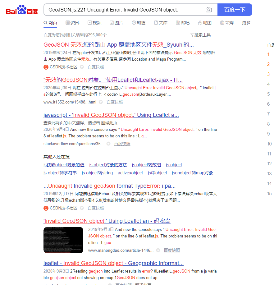
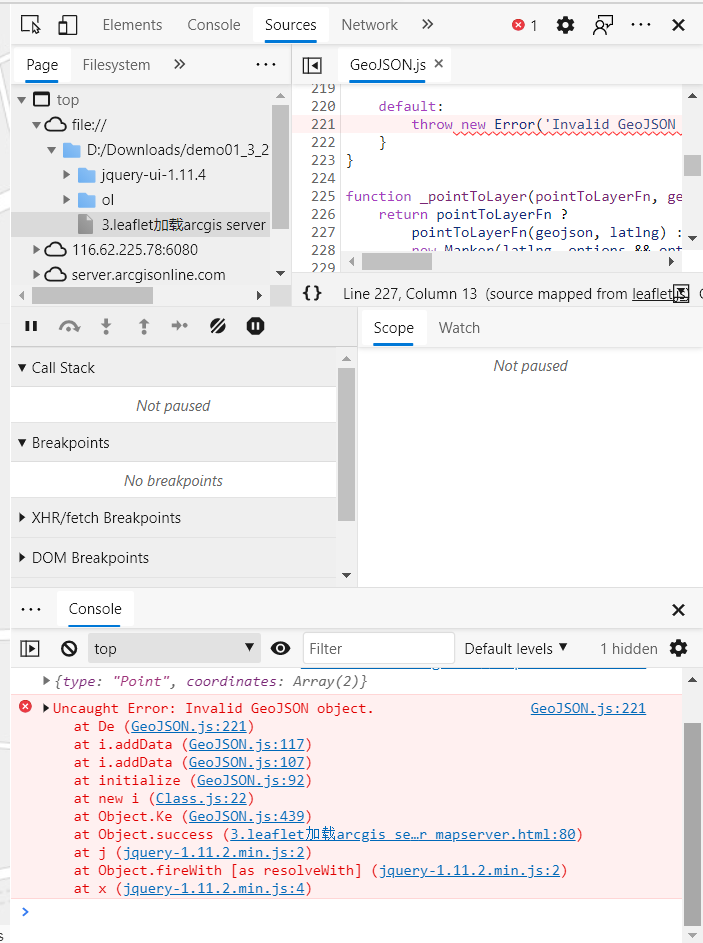
default:
throw new Error('Invalid GeoJSON object.');
}
}
function _pointToLayer(pointToLayerFn, geojson, latlng, options) {
return pointToLayerFn ?
pointToLayerFn(geojson, latlng) :
new Marker(latlng, options && options.markersInheritOptions && options);
}
// @function coordsToLatLng(coords: Array): LatLng
// Creates a `LatLng` object from an array of 2 numbers (longitude, latitude)
// or 3 numbers (longitude, latitude, altitude) used in GeoJSON for points.
export function coordsToLatLng(coords) {
return new LatLng(coords[1], coords[0], coords[2]);
}
// @function coordsToLatLngs(coords: Array, levelsDeep?: Number, coordsToLatLng?: Function): Array
// Creates a multidimensional array of `LatLng`s from a GeoJSON coordinates array.
// `levelsDeep` specifies the nesting level (0 is for an array of points, 1 for an array of arrays of points, etc., 0 by default).
// Can use a custom [`coordsToLatLng`](#geojson-coordstolatlng) function.
export function coordsToLatLngs(coords, levelsDeep, _coordsToLatLng) {
var latlngs = [];
for (var i = 0, len = coords.length, latlng; i < len; i++) {
latlng = levelsDeep ?
coordsToLatLngs(coords[i], levelsDeep - 1, _coordsToLatLng) :
(_coordsToLatLng || coordsToLatLng)(coords[i]);
latlngs.push(latlng);
}
return latlngs;
}
// @function latLngToCoords(latlng: LatLng, precision?: Number): Array
// Reverse of [`coordsToLatLng`](#geojson-coordstolatlng)
export function latLngToCoords(latlng, precision) {
precision = typeof precision === 'number' ? precision : 6;
return latlng.alt !== undefined ?
[Util.formatNum(latlng.lng, precision), Util.formatNum(latlng.lat, precision), Util.formatNum(latlng.alt, precision)] :
[Util.formatNum(latlng.lng, precision), Util.formatNum(latlng.lat, precision)];
}
// @function latLngsToCoords(latlngs: Array, levelsDeep?: Number, closed?: Boolean): Array
// Reverse of [`coordsToLatLngs`](#geojson-coordstolatlngs)
// `closed` determines whether the first point should be appended to the end of the array to close the feature, only used when `levelsDeep` is 0. False by default.
export function latLngsToCoords(latlngs, levelsDeep, closed, precision) {
var coords = [];
for (var i = 0, len = latlngs.length; i < len; i++) {
coords.push(levelsDeep ?
latLngsToCoords(latlngs[i], levelsDeep - 1, closed, precision) :
latLngToCoords(latlngs[i], precision));
}
if (!levelsDeep && closed) {
coords.push(coords[0]);
}
return coords;
}
export function getFeature(layer, newGeometry) {
return layer.feature ?
Util.extend({}, layer.feature, {geometry: newGeometry}) :
asFeature(newGeometry);
}
// @function asFeature(geojson: Object): Object
// Normalize GeoJSON geometries/features into GeoJSON features.
export function asFeature(geojson) {
if (geojson.type === 'Feature' || geojson.type === 'FeatureCollection') {
return geojson;
}
return {
type: 'Feature',
properties: {},
geometry: geojson
};
}
var PointToGeoJSON = {
toGeoJSON: function (precision) {
return getFeature(this, {
type: 'Point',
coordinates: latLngToCoords(this.getLatLng(), precision)
});
}
};
// @namespace Marker
// @section Other methods
// @method toGeoJSON(precision?: Number): Object
// `precision` is the number of decimal places for coordinates.
// The default value is 6 places.
// Returns a [`GeoJSON`](http://en.wikipedia.org/wiki/GeoJSON) representation of the marker (as a GeoJSON `Point` Feature).
Marker.include(PointToGeoJSON);
// @namespace CircleMarker
// @method toGeoJSON(precision?: Number): Object
// `precision` is the number of decimal places for coordinates.
// The default value is 6 places.
// Returns a [`GeoJSON`](http://en.wikipedia.org/wiki/GeoJSON) representation of the circle marker (as a GeoJSON `Point` Feature).
Circle.include(PointToGeoJSON);
CircleMarker.include(PointToGeoJSON);
// @namespace Polyline
// @method toGeoJSON(precision?: Number): Object
// `precision` is the number of decimal places for coordinates.
// The default value is 6 places.
// Returns a [`GeoJSON`](http://en.wikipedia.org/wiki/GeoJSON) representation of the polyline (as a GeoJSON `LineString` or `MultiLineString` Feature).
Polyline.include({
toGeoJSON: function (precision) {
var multi = !LineUtil.isFlat(this._latlngs);
var coords = latLngsToCoords(this._latlngs, multi ? 1 : 0, false, precision);
return getFeature(this, {
type: (multi ? 'Multi' : '') + 'LineString',
coordinates: coords
});
}
});
// @namespace Polygon
// @method toGeoJSON(precision?: Number): Object
// `precision` is the number of decimal places for coordinates.
// The default value is 6 places.
// Returns a [`GeoJSON`](http://en.wikipedia.org/wiki/GeoJSON) representation of the polygon (as a GeoJSON `Polygon` or `MultiPolygon` Feature).
Polygon.include({
toGeoJSON: function (precision) {
var holes = !LineUtil.isFlat(this._latlngs),
multi = holes && !LineUtil.isFlat(this._latlngs[0]);
var coords = latLngsToCoords(this._latlngs, multi ? 2 : holes ? 1 : 0, true, precision);
if (!holes) {
coords = [coords];
}
return getFeature(this, {
type: (multi ? 'Multi' : '') + 'Polygon',
coordinates: coords
});
}
});
// @namespace LayerGroup
LayerGroup.include({
toMultiPoint: function (precision) {
var coords = [];
this.eachLayer(function (layer) {
coords.push(layer.toGeoJSON(precision).geometry.coordinates);
});
return getFeature(this, {
type: 'MultiPoint',
coordinates: coords
});
},
// @method toGeoJSON(precision?: Number): Object
// `precision` is the number of decimal places for coordinates.
// The default value is 6 places.
// Returns a [`GeoJSON`](http://en.wikipedia.org/wiki/GeoJSON) representation of the layer group (as a GeoJSON `FeatureCollection`, `GeometryCollection`, or `MultiPoint`).
toGeoJSON: function (precision) {
var type = this.feature && this.feature.geometry && this.feature.geometry.type;
if (type === 'MultiPoint') {
return this.toMultiPoint(precision);
}
var isGeometryCollection = type === 'GeometryCollection',
jsons = [];
this.eachLayer(function (layer) {
if (layer.toGeoJSON) {
var json = layer.toGeoJSON(precision);
if (isGeometryCollection) {
jsons.push(json.geometry);
} else {
var feature = asFeature(json);
// Squash nested feature collections
if (feature.type === 'FeatureCollection') {
jsons.push.apply(jsons, feature.features);
} else {
jsons.push(feature);
}
}
}
});
if (isGeometryCollection) {
return getFeature(this, {
geometries: jsons,
type: 'GeometryCollection'
});
}
return {
type: 'FeatureCollection',
features: jsons
};
}
});
// @namespace GeoJSON
// @factory L.geoJSON(geojson?: Object, options?: GeoJSON options)
// Creates a GeoJSON layer. Optionally accepts an object in
// [GeoJSON format](https://tools.ietf.org/html/rfc7946) to display on the map
// (you can alternatively add it later with `addData` method) and an `options` object.
export function geoJSON(geojson, options) {
return new GeoJSON(geojson, options);
}
// Backward compatibility.
export var geoJson = geoJSON;
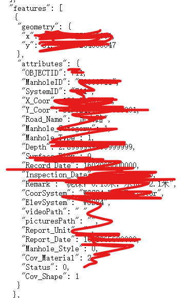
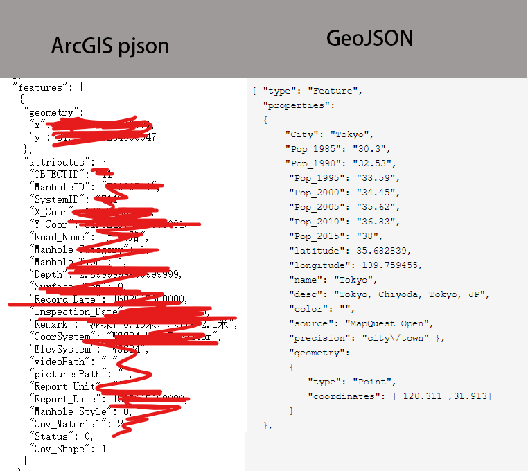
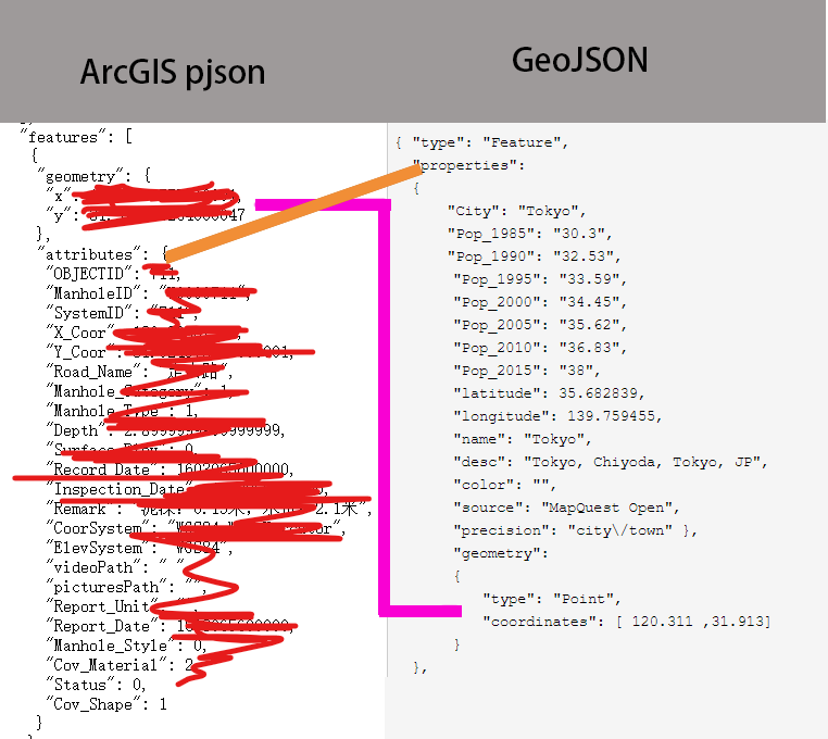
如何转geojson呢?
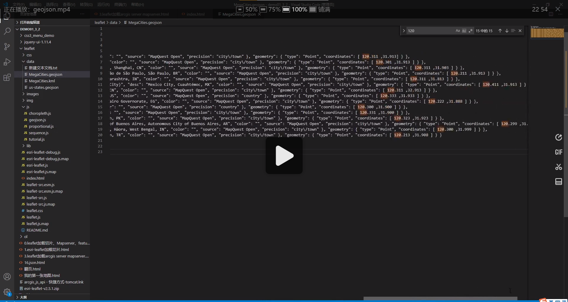
{ "type": "Feature",
  "properties":
  {
      "City": "Tokyo",
      "Pop_1985": "30.3",
      "Pop_1990": "32.53",
    "Pop_1995": "33.59",
    "Pop_2000": "34.45",
    "Pop_2005": "35.62",
    "Pop_2010": "36.83",
    "Pop_2015": "38",
    "latitude": 35.682839,
    "longitude": 139.759455,
    "name": "Tokyo",
    "desc": "Tokyo, Chiyoda, Tokyo, JP",
    "color": "",
    "source": "MapQuest Open",
    "precision": "city/town" },
    "geometry":
    {
      "type": "Point",
      "coordinates": [ 120.311 ,31.913]
    }
  },