工具箱位置 打开ArcToolBox,找到工具集Projections and Transformations,位置如下:ArcToolbox--Data Management Tools--Projections and Transformations

一、如何删除已有数据的坐标系
shp格式:在文件资源管理器中找到存放shp文件的位置,将后缀为.prj的文件删除即可。
gdb或mdb中:将数据导出为shp,在删除gdb或mdb中的源文件,将转换为shp的数据.prj文件删除后,重新导入到gdb或mdb中即可。
写在前面
在ArcGIS中,坐标系可以分为以下几类
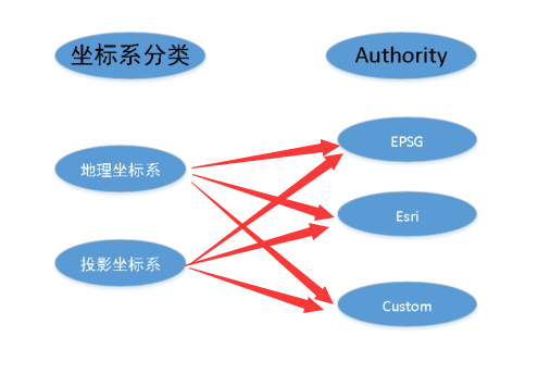
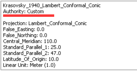
其中,Authority为EPSG和Esri的坐标系,还带有WKID,相当于是坐标系的身份证号码,可以作为唯一标识,而Authority为Custom的,则没有WKID

Define Projection:适用于为一个没有投影信息,或者是投影信息错误的数据集。
工具介绍:http://desktop.arcgis.com/zh-cn/arcmap/latest/tools/data-management-toolbox/define-projection.htm

Project :适用于将空间数据从一种坐标系投影到另一种坐标系。
工具参考:http://desktop.arcgis.com/zh-cn/arcmap/latest/tools/data-management-toolbox/project.htm

其中需要注意的是这个可选参数
关于坐标系信息的相关知识,参见博客:https://www.cnblogs.com/gistrd/p/10169160.html
当两种坐标系之间是不同的椭球体时,Geographic Transformation 会有下拉框,里面有一些ArcGIS支持的不同基准面之间的转换方法,具体支持哪些,参见链接:https://support.esri.com/zh-cn/technical-article/000004829
如果系统中提供的方法不满足实际需求的话,就需要用到Create Custom Geographic Transformation(创建自定义地理(坐标)变换)工具了
工具介绍:http://desktop.arcgis.com/zh-cn/arcmap/latest/tools/data-management-toolbox/create-custom-geographic-transformation.htm