Topology
1. toplology is to describe connectivity between spatial features, which is a collection of rules that coupled with a set of editing tools and techniques, enables the geodatabase to more accurately model geometric relationships提供一种严格定义的方法来自动清除数据输入中的错误并验证数据
2. topology need Data validation(验证) + Spatial analysis
3. typical digitizing procedure
a) digitize all lines
b) build topology
c) label polygons
d) clean up slivers, dangles, and under- and overshoots
e) build topology again, repeating the clean and build phases as many times as necessary
Topological model
1. 用特征几何来定义spatial objects, 他们的关系以及边界特征
2. Two views:
a) features (points, lines, and polygons)
b) topological elements (nodes, edges, faces, and their relationships)
3. 使用功能
a) features are defined by their coordinates(坐标)
b) features are represented as an ordered graph of their topological elements
Topology rules
1. 定义了features之间允许的空间关系
2. The rules you define control the relationships between features within a feature class, between features in different feature classes, or between subtypes of features
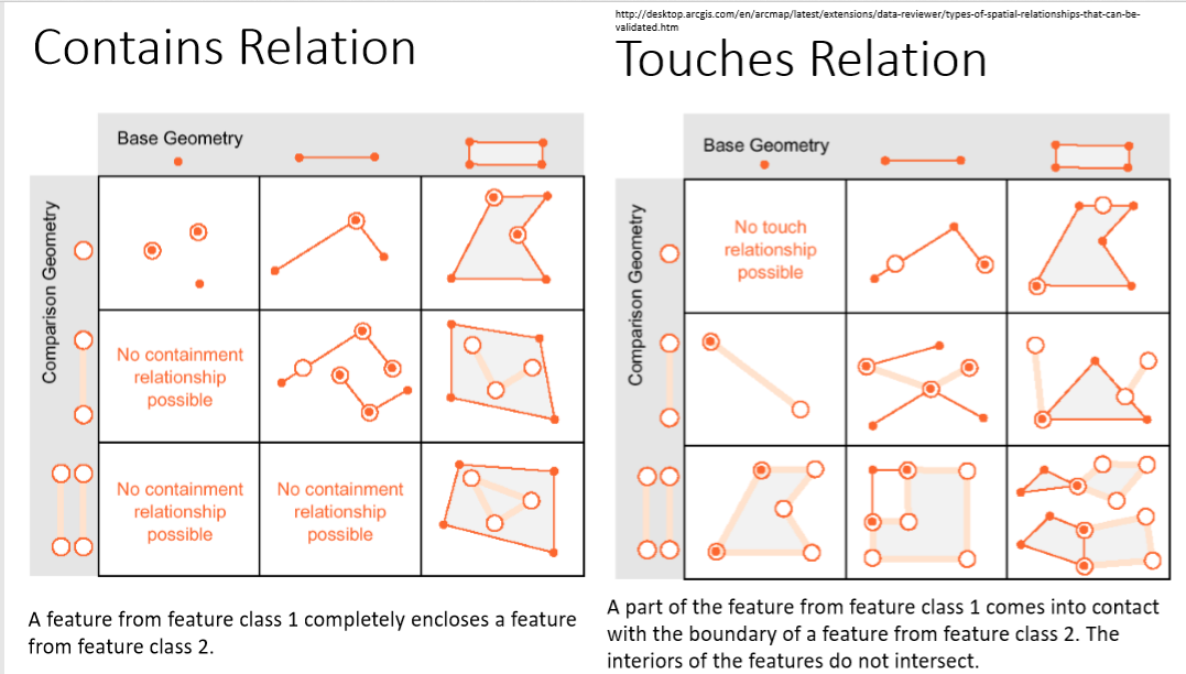
Spatial relationships
1. Spatial relationships express specifically how features share coincident geometry along with the rules for the behavior of their spatial representations
1. toplology is to describe connectivity between spatial features, which is a collection of rules that coupled with a set of editing tools and techniques, enables the geodatabase to more accurately model geometric relationships提供一种严格定义的方法来自动清除数据输入中的错误并验证数据
2. topology need Data validation(验证) + Spatial analysis
3. typical digitizing procedure
a) digitize all lines
b) build topology
c) label polygons
d) clean up slivers, dangles, and under- and overshoots
e) build topology again, repeating the clean and build phases as many times as necessary
Topological model
1. 用特征几何来定义spatial objects, 他们的关系以及边界特征
2. Two views:
a) features (points, lines, and polygons)
b) topological elements (nodes, edges, faces, and their relationships)
3. 使用功能
a) features are defined by their coordinates(坐标)
b) features are represented as an ordered graph of their topological elements
Topology rules
1. 定义了features之间允许的空间关系
2. The rules you define control the relationships between features within a feature class, between features in different feature classes, or between subtypes of features
Spatial relationships
1. Spatial relationships express specifically how features share coincident geometry along with the rules for the behavior of their spatial representations
2. Draw a line from the point to infinity in any direction, and count the number of intersections between this line and each polygon’s boundary. The polygon with an odd number of intersections is the containing polygon: all other polygons have an even number of intersections
# You cannot create network datasets or perform topology rules on rasters
# You cannot create network datasets or perform topology rules on rasters