1. Coordinate(坐标) data for GIS
real coordinate system:Cartesian coordinate systems(笛卡尔坐标系)
from 3D to 2D, the earth can be modled as a sphere(球体), oblate ellipsoid(扁椭圆体), geoid(大地水准面). We need a cartographic projection(地球投影),a datum(基准面) to do this.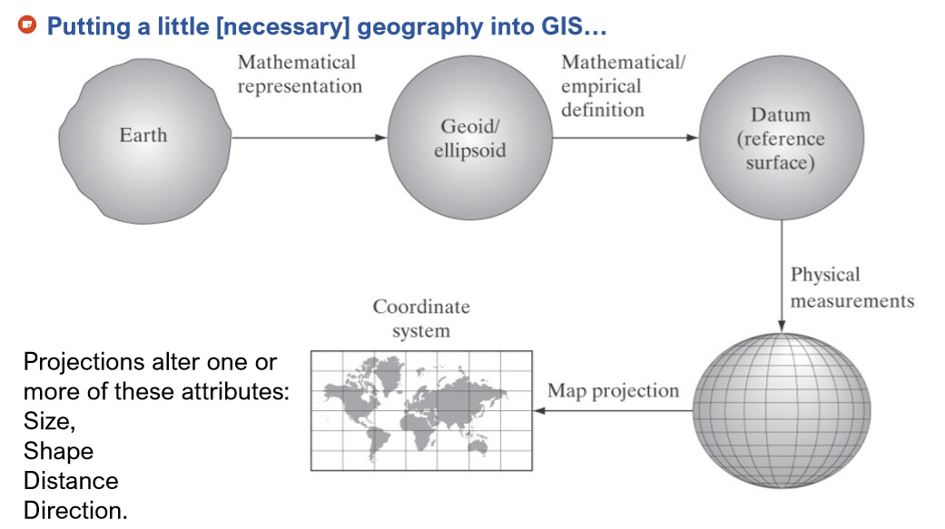 but there always a trade off2. datuma. the first national horizontal datum: Australian Geodetic Datum (AGD66) in 1966b. new Geocentric Datum of Australia 1994 (GDA94) c. a new one is gonna coming in 2020#Converting between projections: transform data to a common cartographic projection3. GDA94units:metreUTM projectionnorth+east:等角横轴割圆柱投影,圆柱投影是将一个圆柱面包围椭球体,并使之相切或相割,再根据某种条件将椭球面上的经纬网点投影到圆柱面上,然后,沿圆柱面的一条母线切开,将其展成平面而得到的投影。其中正轴圆柱投影的圆柱轴同地轴重合,横轴圆柱投影的圆柱轴同赤道直径重合,斜轴圆柱投影的圆柱轴同地轴和赤道直径以外的任一直径重合。false easting(东伪偏移): 投影平面中为避免横轴(经度方向)坐标出现负值,而所加的偏移量false northing(北伪偏移): 投影平面中为避免纵轴(纬度方向)坐标出现负值,而所加的偏移量4. GLONASS: 全球导航卫星系统, used to know location without gps5. metadatadata quality can not be changed from general to specialize, but otherwise is fine. for example, if we got the data quality of a 30*30, we do not know the data quality of a 5*5, but otherwise we will know the data quality of 30*30 if we know the data quality of 5*56. data dictionary简单记录了我们所需要的数据,但不是所有信息(在该地点考察并记录,可能包含一些估计值)metadata包含了如何制作数据(如何制造这个地图)7. meta data standard: ISO8. spatial information: triangulation or gridding