分类:按照不同的属性分类渲染显示。https://blog.csdn.net/qingyafan/article/details/45398131
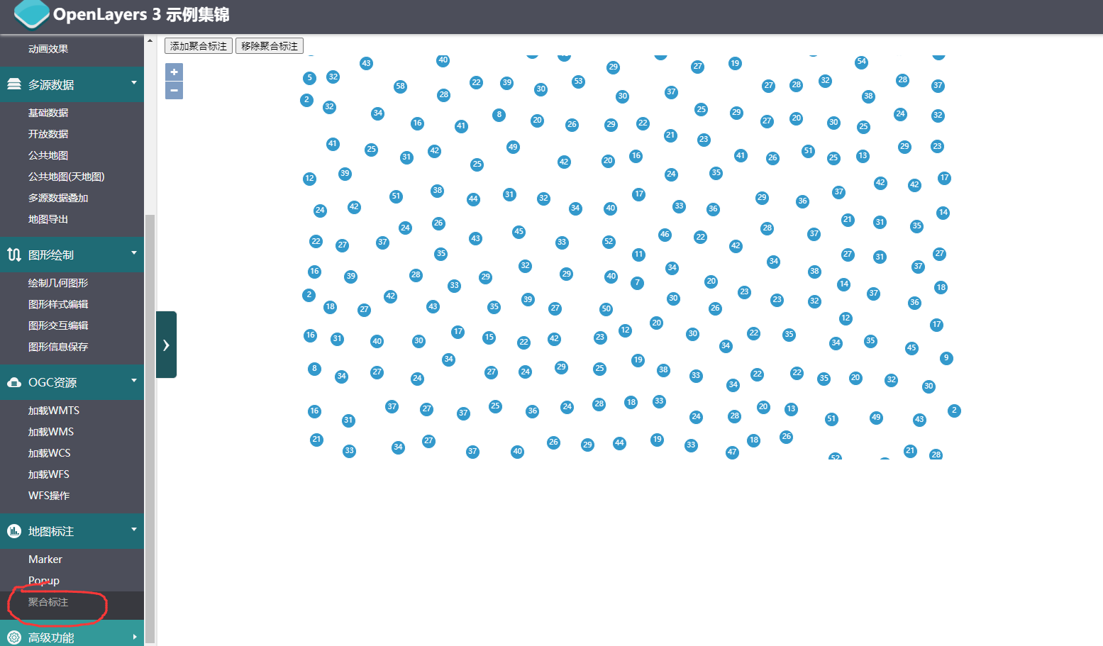
聚合:
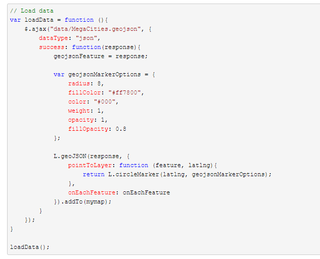
第一步:加载geojson
第二步:分为几个geojson
第三步:画到图上
geojson如何按照某个属性切分。。
切分好以后如何动态的加载到地图上
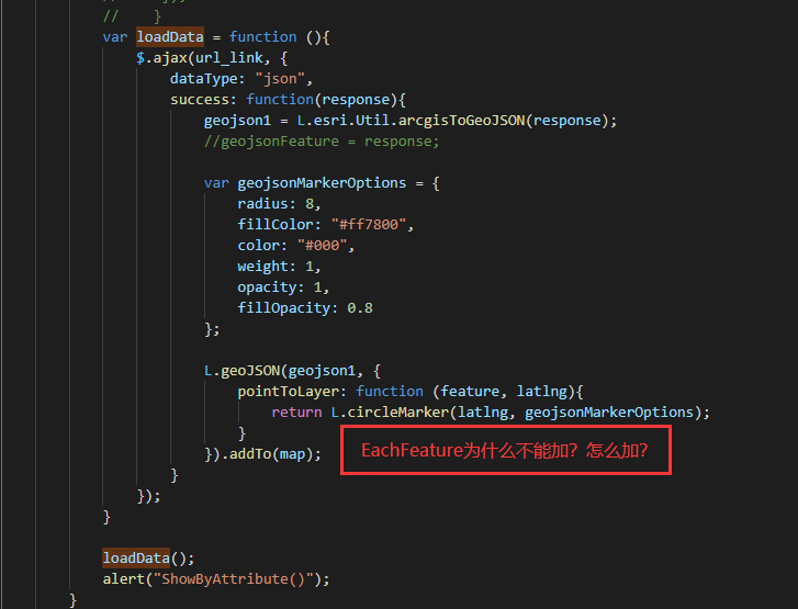
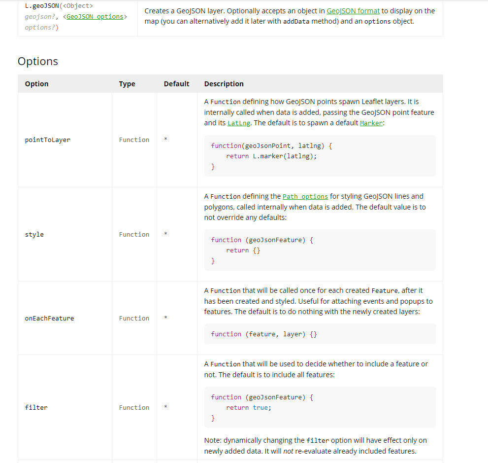
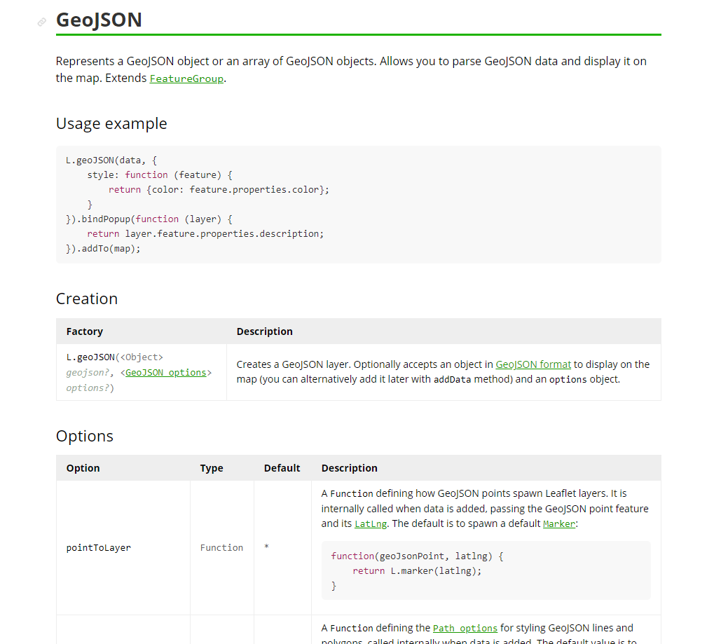
(1)geojson直接画上去 geojson_layer?
(2)geojson转成vector layer再画到map上?addtoMap
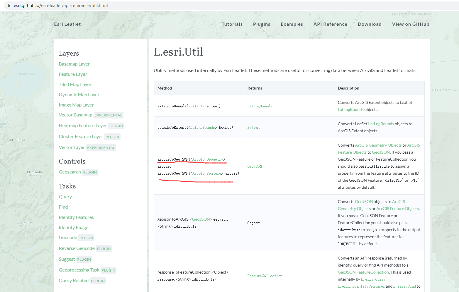
>>leaflet arcgis geojson:
https://blog.csdn.net/qq_36213352/article/details/81843021
点的显示样式怎么更改?:
https://www.cnblogs.com/kkyyhh96/p/10386655.html
https://zhidao.baidu.com/question/628373152507706004.html